August 29, 2023
 Thom Carroll/For PhillyVoice
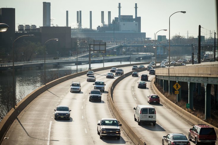
Philadelphia has high levels of nitrogen dioxide – and they peak during rush hour, according to images from a new NASA instrument that monitors air pollution levels from space. The pollutant, released by burning fossil fuels, aggravates asthma.
The air over the Philadelphia region has high concentrations of toxic pollutants, according to new data from a spectrometer floating in outer space.
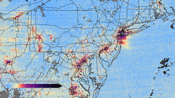
Visualization maps released by NASA show hot spots of nitrogen dioxide, a gas produced by burning fossil fuels, across North America. Cities along the East Coast — including Washington, New York and Philadelphia — light up with high concentrations, particularly around 4:30 p.m. This tracks with rush hour traffic patterns, when hundreds of cars hit the road and release the pollutant into the air.
But transportation isn't the only source of nitrogen dioxide. The gas is also produced by power plants, construction and wildfires, which have impacted much of the U.S. and Canada this summer. When nitrogen dioxide enters the atmosphere, it can create smog or acid rain, and aggravate respiratory conditions, particularly asthma, for the people breathing in that air.
The NASA data comes from the first space-based instrument created to continuously measure air quality over North America with the resolution of a few square miles. It captures hourly scans of the lower atmosphere during the day from 22,000 miles above the equator. The instrument, known as Tropospheric Emissions: Monitoring of Pollution, or TEMPO, was launched into orbit in April.
A 2021 report from the Philadelphia Department of Public Health found nitrogen dioxide levels have been trending downward since 1980, but there was a slight bump recorded between 2018 and 2019, which mostly plateaued in 2020 and 2021. The city has flagged Nicetown as a "neighborhood of interest" for its high concentrations of nitrogen dioxide and fine particulate matter.
NASA's new spectrometer, which measures air pollution from space, recorded high levels of nitrogen dioxide in New York, Philadelphia and Washington earlier this month.
Philadelphia's air monitoring station in Fairmount Park captured nitrogen dioxide levels of 17.11 parts per billion on Tuesday morning. That is well below national air quality standards, which are capped at an annual average of 53 ppb.
But the city experienced several bouts of severe air pollution from particulate matter in June as smoke from wildfires in Canada traveled south and created hazy skies over the Northeast and Mid-Atlantic. On June 7, the air quality in Philly was briefly the worst of any major city in the world, reaching 447 on the air quality index established by the U.S. Environmental Protection Agency. The scale maxes out at 500, and anything above 300 is considered a "Code Maroon," which indicates hazardous, emergency conditions.
The air quality index also tracks nitrogen dioxide, one of five pollutants regulated by the Clean Air Act.
Follow Kristin & PhillyVoice on Twitter: @kristin_hunt
| @thePhillyVoice
Like us on Facebook: PhillyVoice
Have a news tip? Let us know.
 Provided image/NASA's Scientific Visualization Studio