The new maps: A visual guide to your congressional district
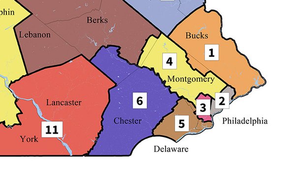
A portion of the new map depicting redrawn congressional districts in Pennsylvania.
Source/Pennsylvania Supreme Court
by PhillyVoice staff
The Pennsylvania Supreme Court on Monday unveiled new congressional districts for state voters after it ruled the current districts were gerrymandered to give political advantage to the Republicans.
One note: most area voters will have a new congressional district number.
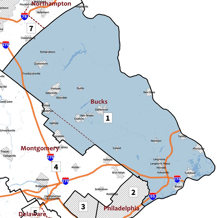
FIRST CONGRESSIONAL DISTRICT
Source/Pennsylvania Supreme CourtThe redrawn First Congressional District encompasses Bucks County and a small part of Montgomery County, including Lansdale and Hatfield.
SECOND CONGRESSIONAL DISTRICT
Source/Pennsylvania Supreme CourtThe redrawn Second Congressional District encompasses Northeast Philadelphia, the River Wards and parts of North Philadelphia, east of Broad Street.
THIRD CONGRESSIONAL DISTRICT
Source/Pennsylvania Supreme CourtThe redrawn Third Congressional District encompasses West Philadelphia, Northwest Philadelphia and Center City.
FOURTH CONGRESSIONAL DISTRICT
Source/Pennsylvania Supreme CourtThe redrawn Fourth Congressional District encompasses most of Montgomery County and a small part of Berks County, including Boyertown.
FIFTH CONGRESSIONAL DISTRICT
Source/Pennsylvania Supreme CourtThe redrawn Fifth Congressional District encompasses Delaware County, South Philadelphia, Southwest Philadelphia and part of Montgomery County, including Bryn Mawr, Villanova and Ardmore.
SIXTH CONGRESSIONAL DISTRICT
Source/Pennsylvania Supreme CourtThe redrawn Sixth Congressional District encompasses Chester County and part of Berks County, including Reading.