April 14, 2016
 Source/NOAA
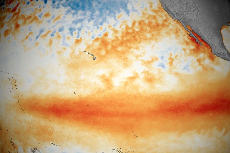
Tropical Pacific sea surface temperature patterns for March 2016, showing El Niño conditions.
The strong El Niño that has shaped weather patterns in Philadelphia and beyond since last year is on the decline and predicted to end by early summer.
In their April update, forecasters with the National Oceanic and Atmospheric Administration said La Niña could be setting up in a follow-up act. NOAA issued a La Niña Watch, meaning that conditions were favorable for development within the next six months. Not all El Niños are followed by La Niñas, but it's more likely that La Niña could develop by fall.
According to NOAA:
La Niña — the opposite of El Niño — is a natural ocean-atmospheric phenomenon marked by cooler-than-average sea surface temperatures in the central Pacific Ocean near the equator. During the winter, typical La Niña effects include drier and warmer-than-average temperatures over the southern United States, and cooler-than-average temperatures in the southern tier of Alaska, Pacific Northwest and across the Midwest.
Both El Niño and La Niña influence the formation of hurricanes in the Atlantic. Typically, El Niño leads to fewer hurricanes because of stronger wind shear which rips potential hurricanes apart. La Niña tends to reduce that wind shear — potentially meaning more hurricanes.
NOAA said it will issue its 2016 Atlantic Hurricane Season Outlook on May 27.